The drone phenomenon and technology has literally exploded into our reality, with drones being touted as the future of almost everything and across multiple applications. From playing policeman in cyber and home security, fast food pizza delivery to paramedic in search and rescue operations, nature conservationist in wildlife tracking and scuba diver in underwater exploration, the ‘eyes in the sky’ have become the preferred replacement partner when circumstance precludes getting a person there on time or placing them in a particular environment.
Following on from our article on GPS Technology, where we explored global positioning systems and its application in the world of engineering and construction (E&C), we explore further the current and future use of drones operating in an E&C capacity.
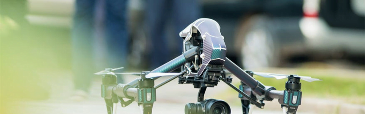
Drone technology explained
Drones, or Unmanned Aerial Vehicles (UAVs) incorporate GNSS technology, which stands for Global Navigation Satellite System, are responsible for the navigation functionality that provides autonomous, geo-spatial positioning with global coverage. The term includes GPS, GLONASS and Galileo technologies. The device offers the user a compact and universal tracking apparatus with multiple communication tracking channels ensuring accuracy in data collection and analysis. The UAV is guided by a grounded pilot and the GNSS contributes by providing feedback to the control algorithm.
Recently, leading multinational software company, Autodesk, became involved in drone technology when it invested in a company that makes hardware and software for the construction industry, specialising in drones that are equipped to scan the built environment and transmit data directly to the cloud.
Drones on the construction site
For those professionals working in the construction industry, drones are a noteworthy cost and convenience saver. On average, they are easier to fly and cheaper to operate than a commercial aircraft. They are also faster and more accurate than their human counterparts. Coupled with advanced technology and computerised tools, the collective intelligence allows E&C professionals the ability to operate more efficiently through accurate deployment of resources, which minimises risk and costs, and maximises safety and accuracy.
Currently, the most popular use of drones in E&C include:
- Land surveying – covering large areas quickly and accurately
Land surveying is a technique required to measure distances and angles between different points. Back in the day, land surveyors were expected to collect this information manually which entailed trailing across large sections of land, measuring by hand and inputting data. Not only was this time consuming but the problem of human error was a real threat to the project.
Assisting in land surveying, in varying degrees of application, is undoubtedly one of the most favoured uses of drones in the industry and is quickly growing momentum.
The capabilities are pretty impressive – a drone can provide a platform for obtaining survey data due to its sensor and camera features. The drone uses GPS controlled flight plans to map out photographic systems, providing high resolution images which, when overlapped, can be used to produce 3D surface models for topographic representations of, for instance, job sites or a particular landmark.
One of the most lucrative features of a drone is its speed of service. Data collected is both highly accurate and expediently obtained. According to drone technologists it is estimated that the average lead time for a traditional survey of a 400,000 sqm area, with the assistance of a helicopter is approximately 12 weeks. This includes the booking time, data gathering and processing. A manned survey team increases to 13 weeks. A specialised drone can complete the data collection in under ten minutes and provides the entire service in approximately six hours!
- Communication – real-time information
Drones assist with communication by tracking day-to-day progress of construction sites or project plans. Instant connectivity and real-time information are a must-have in the E&C industry and drones are able to monitor and report back on work progress, equipment and staff members. Some companies have reported seeing an increase in productivity and efficiency due to reliable monitoring and management of their assets through drone supervision.
The E&C industry has already reported an increase in efficiency due to a number of technological innovations, like BIM, and being able to gather data and manage workflow in a 24/7 capacity goes a long way in ensuring unprecedented precision management of a project.
- Monitoring & Inspection
Monitoring a commercial construction site is both a challenging and time-consuming undertaking, while drones make it all the more easier by collecting data, including video footage, of a site and deploying this directly to management who can gauge an accurate understanding of project progress not to mention an assessment of structural integrity.
Drones put safety first by offering to take the human element out of a once dangerous task. The construction site or engineering project often involves hazardous conditions, materials or conditions that could pose a direct risk to those undertaking an inspection or conducting routine maintenance. Drones offer a better alternative and have the added advantage of being able to access a larger surface area faster or gain entry to previously inaccessible areas, like those in the mining industry or offshore oil drilling operations.
- The Future
The successful use of drones has led to speculation that its uses could be extended to industrial transportation. The idea of transporting goods aerially, especially hazardous material or to areas posing a safety risk would further mitigate risk to human life and increase the effort to streamline efficiency.
At Baker Baynes, we employ the latest technology to help you ‘work clever, not harder’ so contact us to find out what solutions we can offer to suit your business.


0 Comments